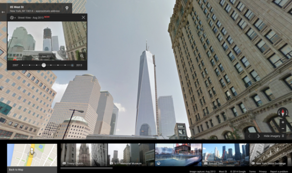
Google introduced a feature Wednesday that lets you step back in time to earlier versions of its collected Street View data. You can now visit places in Street View as early as 2006, comparing them to what locations look like today.
The Verge reports the option was derived from the tsunami that struck off the coast of Japan in early 2011, devastating the country.
According to The Verge:
“In the aftermath [of the tsunami], Google set out to preserve imagery it had captured prior to the disaster, including original Street View recordings that became an unintended time capsule. The company made a one-off site called “Memories for the Future” that let viewers see certain areas before and after the devastation. It was an unusual site considering Google’s standard operating procedure: a feverish pace of updates that erased the old with the new and never looked back.”
Here’s how the new time travel option works.
When you visit a place in Google Street View, there will be a little clock in the top left corner:
Clicking on the clock will allow you to choose a year (dating back to 2006) and an updated image will show that same location as it was in whatever year you chose.
You can scroll between photos taken in different years. You’ll always get the best image Google has available, as algorithms are in place to weed out blurry photos or pictures taken in bad weather.
The Associated Press reports that some Street View pictures posted through the years have “upset people who were captured in activities or visiting places that they wanted to keep private.”
Google now blurs the images of people who contact the company asking to be shielded from Street View, even if it’s just because they don’t like the way they look in the photo.
source: businessinser.com


